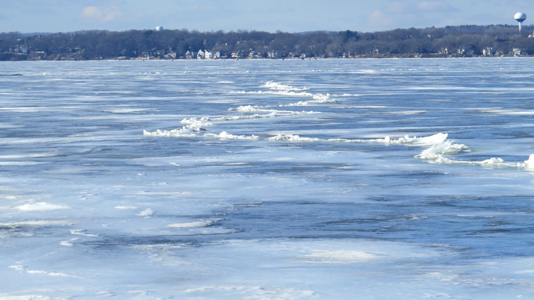
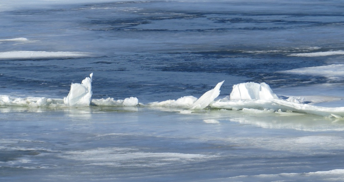
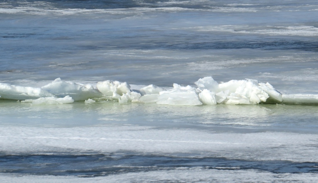
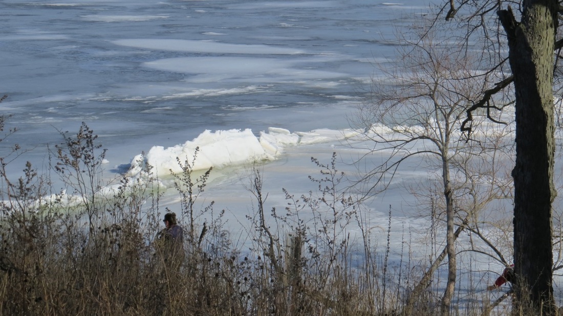
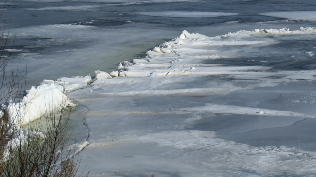
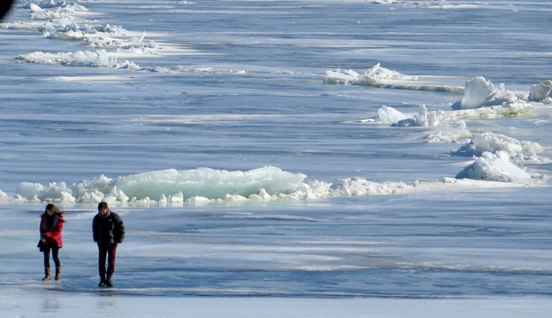
If we assume a two-mile-long slab of ice, that slab is about 10,000 feet in length; and 0.05% of 10,000 feet is 5 feet. So with a 10°C drop in temperature the ice will pull 5 feet apart, somewhere, a good-sized crack. Similarly, a 10°C rise in temperature will produce 5 feet of additional ice — and that expanded ice slab has to go somewhere – pushed up into a ridge offshore, or pushed down and under another slab (perhaps along the location of the earlier crack), or pressed against the shoreline.
There is some evidence that local contraction/expansion can begin in shallow areas– perhaps the temperature changes are most pronounced in these shallow areas, or perhaps the ice tends to be thinner there. But for whatever reason, there is observational evidence, accumulated from watching the lake for many years, that cracks and ridges often spread from Picnic Point or from other shallow areas. • One frequent crack/ridge system extends from Picnic Point towards Maple Bluff. • Another extends from Picnic Point toward the shallow areas near the Edgewater (this is the one you observed yesterday). • Still another extends from Picnic Point past Frautschi Point and then on to the north towards Fox Bluff. • Governors Island may be another relatively shallow area that might favor expansion/contraction joints. In 1956, two Wisconsin scientists, Bunge and Bryson, wrote a series of papers about ice on Wisconsin lakes, including Lake Mendota. They discuss the physical processes of crack/ridge formations. They don’t reach firm conclusions about preferred locations, although they note that these features often extend outward from Picnic Point. You ask ‘why is the crack not a straight line’? That is a very tough question. Nature doesn’t seem to like straight lines (the twisted branches of oak trees, the meandering of rivers, the outlines of cumulus clouds, curving coastlines, etc). These cracks and ridges are subject to many other forces besides contraction/expansion– shearing force and wind forces, for example. So it seems complicated. On January 15, 1948, there was a very powerful crack of the Lake Mendota ice that was felt throughout the campus and city. A description of this “ice quake” event was published by Prof. Charles Bradley (husband of Nina Leopold Bradley) in the American Journal of Science, vol. 246, no. 6, page 390. It measured 3.8 on the Richter scale of a local campus seismograph. There is also a news release about a much smaller ice quake in 2008 (http://www.news.wisc.edu/14680). If one walks or skates on Lake Mendota, one frequently hears the sharp sound of the ice cracking. Gisela and I have heard it. Even to the ‘informed ear' these sounds seem mysterious and powerful, and it is not hard to believe the accounts that in medieval times people gave all kinds of interpretations to these sounds (lake gods or devils or omens of various kinds). A word of caution! A pressure ridge is a small zone of complex topography: some ice slabs are pushed up, others may be pushed down. A downward-pushed slab may be covered by water (it's easy to see) or by a thin layer of newly formed ice (it's not so easy to judge the thickness). Enjoy viewing the power of nature at work, but always be cautious when near a pressure ridge. John Kutzbach, Jan 19, 2015
1 Comment
 Indian mound on the highest point of Eagle Heights Woods. Photo G. Kutzbach Indian mound on the highest point of Eagle Heights Woods. Photo G. Kutzbach Eagle Heights Woods beckon for a silent walk in winter - with sunshine, fresh air, tracks in the snow, and an Indian mound on the highest point with views across the lake. We search for history and our place in this history.
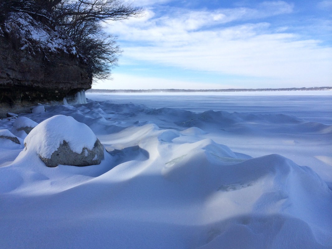 Raymer's Cove in January. Photo Madeleine Young Raymer's Cove in January. Photo Madeleine Young Madeleine Young, beloved 4K teacher at Eagle's Wing Pre-School, enjoys the Preserve during her lunch breaks. This week she dared the cold and walked the short distance from the Eagle Heights Community Center to Raymer's Cove. What a view – the cliff decorated with thick ice stalactites and the snow on the lake swirled in fatastic patterns. Check it out and send us your photos.
|
AuthorGisela Kutzbach and contributors Archives
May 2022
|


 RSS Feed
|
Friends of the Lakeshore Nature Preserve
P.O. Box 5534 Madison, WI 53705 UW-Madison Lakeshore Nature Preserve website Documents |

|